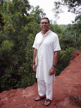
Friday, March 21, 08
Darwin is in the Northern Territory (NT)-a territory and not a state since the population is too small. This known as the Outback. Pat King, I know Pat from my connection to the listserve MKNET, meets me at the airport and we hurry to her place where I shower and have a bread with jelly. On we go heading to Katherine which is several hundred km south along the Stewart Highway. If this highway is followed for 1450 km we would arrive in Alice Springs. From there it continues south many more km to Adelaide on the south end of Australia. Along the way are dead wallabies and other road kill. Cell phone reception cuts off a few km out of Darwin. There will be none till Katherine, and then only in town. In Adelaide River we stop to walk the war cemetery of civilians and military (mainly airmen) personnel killed during the defence of Darwin during WWII. Along the highway are dirt airstrips which were used by fighter planes to intercept the Japanese zeroes and bombers. This is the point where the invasion of Australia was to come. Each airstrip is 5000 ft long X 100ft wide. They were built by the US Army Corps of Engineers. In Adelaide River Pub is the stuffed remains of the buffalo in Crocodile Dundee. This is the area in which that movie was filmed. On to Pine Creek, still no phone coverage, and a look at the old gold mines. These spots are literally sometimes only a pub, or a service station. In Katherine, it being Good Friday, nothing is open except the Kumbidgee Lodge and Tea Rooms. And of course, some lodgings. We park at the St. John Ambulance station and walk in looking for Trevor. Instead, we find Matt and Andrew (my two oldest sons are Matt and Andrew). Matt offers to take me on an ambulance run tomorrow late afternoon. Otherwise, we are invited to tea at 6:00 at the Kumbidgee Lodge where the ambulance group will have dinner and drinks. Drinks! Oh, let's talk about alcohol. There is limited alcohol allowed in Katherine, only certain hours on the weekend and several hours on Wednesday. The effort is to cut the alcoholic consumption of the Aboriginal people. There are large fines if alcohol is transported into the Aboriginal lands. Much of NT is Aboriginal homelands. Accommodations are cabins at Knotts Crossing Resort. To the north stretches the immense Kakadu National Park.
Taking a drive along the Katherine River there is evidence of flooding. This region receives rains 4 months of the year with 40 inches during that period. At times, there is a rise of the river which can flood the town. Climbing the other side of the bank, having crossed the low level bridge, is the Springvale Homestead with buildings built in the middle 1800s. A homestead is the living quarters of a land farm which could encompass thousands of acres. These large farms were called stations. The whole area has blue, white, and red eucalyptus. Don't ask me the difference. The river is spanned by two bridges which are referred to as the low and high levels. High level is 18 meters (app. 60 ft) above the low level bridge and will at times flood several meters above that high level. The volume of water can change dramatically and quickly.
The evening is spent getting to know, in an informal manner over fish and chips, the local ambulance group at the Kumbidgee Lodge. Here, in the Outback, these are often the only link to real health care for Katherine and the outlying communities. At 8:00, the group heads home leaving me to an early night. With only 2 hours of sleep last night, and a nap of 1 1/2 hours this afternoon, my pillow will be welcomed.
Subscribe to:
Post Comments (Atom)

No comments:
Post a Comment